

Geology and Glaciology—rocks and ice—are directly connected; ice is the brush, and rock is the canvas in what becomes a work of natural art. Add water in other forms, and a myriad of plants and animals to the mix, provide a great deal of respectful attention and heartfelt preservation efforts, and Olympic National Park is the result. Whether viewed from Hurricane ridge, from the beach, on wilderness trials, or atop the rocks and ice of its nearly 200 peaks and summits, each experience in the Park provides an astounding snapshot of it now, and a glimpse into its restless icy past.
WHY
With the Pacific—the largest ocean in the world—delivering an enormous amount of moisture across the northwestern portion of Washington State, is it any surprise that there is often record snowfall in the alpine regions of the Olympic Mountains and the northern Cascades? A near continuous track of warm moisture-laden Pacific air stretches northeasterly from the Park’s western shore across the Olympic and Cascades into Canada. In that track of weather, within 160 miles of each other and in nearly a straight line, four phenomena occur:
- Twelve feet of rain falls, annually, in the Olympic Rain Forest.
- The world’s greatest annual snowfall occurs on Mount Olympus.
- The world’s wettest snow falls on the Blue Glacier on Mount Olympus.
- The world’s greatest snowfall accumulation happens on Mount Baker,
in the northern range of the Cascade mountains.
WHAT
 All this moisture falling as snow in the mountains translates into glaciers. When cold winter snow accumulates, transforms its crystalline structures, compacts, and becomes ice—and that ice is not melted by the warmth of summer, removing more water than winter added, and that happens year after year—a glacier is formed and grows.
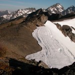
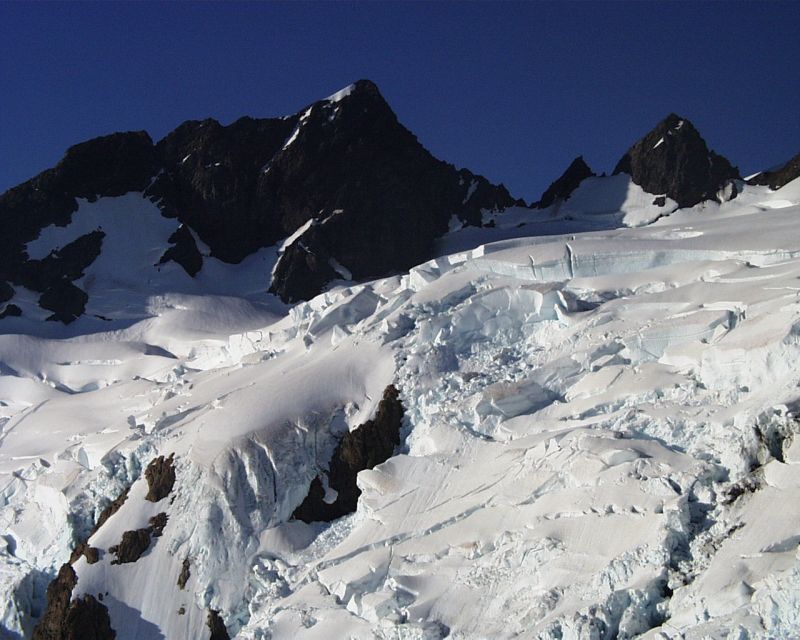 The glaciers in the Park benefit from the winter snow delivered on the moisture-laden Pacific air, but that airflow also tends to warm the Park in the summer months, contributing to increased melting. Melting is also accelerated because the glaciers exist at relatively low and warmer elevations—less than 8,000 ft. The effect within the Park has been the continued existence of glaciers left over from the last Ice Age. Many glaciers have melted away over those 10,000 years, but nearly 200 still remain within the Park today. All are stressed as warming continues, reducing some to remnants, more static ice than true glaciers.
During the last Ice Age, continental glaciers surrounded the Park on all but its west side, with layers of ice up to 3,500 feet thick. This scouring by the continental glaciers created a noticeably sharp rise from sea level on the flanks of the mountains on the east and north edges of the Park. At the same time, today’s river valleys were choked with floes of ice from alpine glaciers, the remnants of which dot the Park’s mountains today. These alpine glaciers were the first to melt, but because continental ice blocked the lower ends of these valleys, lakes were formed by the water that couldn’t escape to the sea. Ice from the larger continental glaciers calved and floated as icebergs in these valley lakes. Debris, including huge rocks carried on the continental ice sheet from Canada, drifted on the icebergs until they capsized. Hikers in these valleys today often come upon rocks the size of houses or cars, of a type not native to the Park. Delivered by the ice age glaciers, these rocks are called glacial erratics. An example is granite that originated in the Frasier river canyons of British Columbia.
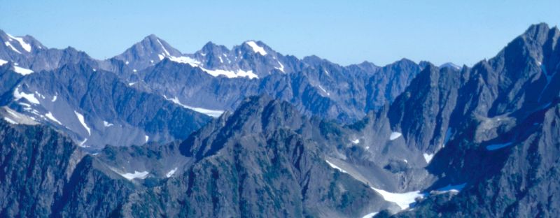
As the valleys were freed from both the ice that formed them and the lakes that followed, the valley walls began to slump, unable to support their own weight on the steep slopes that the glacier had supported. The result is a serrated pattern on the ridgelines, characterized by peaks alternating with dips. This pattern appears all over the Park.
WHERE
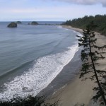
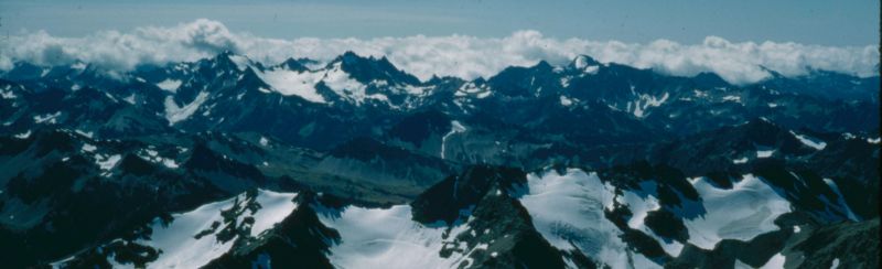
From the vantage point of Hurricane Ridge (N47 58.160 W123 29.904), at 5,240 feet, 17 miles south from the Park’s main Visitor Center in Port Angeles, glaciers on a number of peaks are in full view. A stunning view of the Blue Glacier on Mount Olympus is possible year-round on a clear day from Hurricane Ridge. It sits 14 miles distant to the southwest and although viewable with the naked eye, binoculars or a spotting scope will greatly enhance the experience.
For more information, visit these websites: